

Defining maritime zones, writing alert rules that earn attention, and avoiding the alert fatigue that quietly kills most monitoring set-ups.
Vessel geofencing lets a maritime team draw a boundary around a port, anchorage, terminal, coastal region, offshore asset or sensitive area, and be told when a vessel interacts with it. Instead of checking a map repeatedly, the team asks the platform to surface specific entries, exits, movements or changes in status.
That is the easy part. The difficulty is that a geofence which fires too often is worse than no geofence at all, because it trains people to ignore the system. This guide is about designing rules that survive contact with a working operations team.
What a geofence is
A geofence is a digital geographic boundary: a circle around a point, a polygon following a port or coastal area, or a more complex custom zone. The platform compares incoming vessel positions against that boundary and generates an event when the configured conditions are met.
Common event types include entry into a zone, exit from it, presence within it, dwell beyond a specified period, movement above or below a speed threshold, a change in navigational status within the area, and a reporting gap near a sensitive location. Which are available depends on the platform and the underlying data. The principle that matters is that a geofence should express an operational condition, not merely a shape on a map.
How commercial teams use them
Port and terminal monitoring
Zones around approach areas, anchorages, berths and port limits support arrival and departure monitoring. Agents, terminal teams and fleet operators use the resulting alerts to identify when a vessel reaches a defined stage of the port call and to coordinate what happens next.
Exception management
An operations team does not need to watch every routine movement. Geofences let them watch for the exceptions instead: a vessel enters an unplanned area, stays at anchor longer than expected, approaches a restricted zone, or departs before a planned milestone is complete.
Security and risk
Security teams define zones around higher-risk waters, offshore infrastructure and areas subject to company procedures. The alert is an early prompt to review the vessel’s route and current movement, not a conclusion.
Chartering and market awareness
Geofences are not limited to owned tonnage. Commercial teams monitor selected ports, anchorages and trading areas to understand fleet activity and vessel availability, subject to their organisation’s data and compliance policies.
Regulatory and environmental oversight
Authorities and regulated operators use zones to support oversight of protected areas, fishing grounds, emission control areas and other locations where vessel activity warrants attention. Again, an alert is a starting point for review rather than evidence of a breach.
Designing a geofence that works
Geofencing works best when the boundary and the rule reflect the decision the user needs to make. A large zone gives early warning but generates volume. A tight zone reduces noise but may alert too late to be useful. There is no universally correct answer, only a correct answer for a given operation.
Before creating a zone, settle seven things.
- The operational question. What should this alert tell the team, in one sentence?
- The vessels in scope. Owned fleet, watchlist, vessel type, or all traffic?
- The boundary. Official port limits, a berth area, a safety buffer, or a custom region?
- The event condition. Is entry enough, or is a dwell, speed or status rule needed?
- The recipient. Who is responsible for reviewing and acting on it?
- The urgency. Immediate notification, a dashboard flag, or a line in a daily report?
- The evidence. What movement history and vessel detail should be available when the alert is opened?
If question one cannot be answered cleanly, the zone is probably not worth creating.
A worked example
A bulk carrier is due at an anchorage where waiting times are usually under twelve hours. The operations team draws a zone around the anchorage and sets two rules: notify the duty agent on entry, and raise a second alert if the vessel is still inside after eighteen hours.
The vessel enters at 0340 and the entry alert goes to the agent’s overnight queue rather than to a phone, because arrival at anchorage is expected and not urgent. Eighteen hours later the second alert fires. This time it matters. The agent opens the vessel’s history, sees three previous calls at the same berth cleared in under ten hours, checks nearby traffic and finds four other vessels waiting in the same anchorage.
The conclusion is congestion rather than a problem with this ship. The agent updates the charterer before being asked.
Alert fatigue is the real failure mode
The fastest way to make geofencing useless is to alert too often. Once routine arrivals, departures and position updates all generate notifications, users stop reading them, and the one alert that mattered is lost among the ones that did not.
Practical countermeasures: apply rules only to relevant fleets or vessel categories; use dwell or speed conditions rather than alerting on every entry; separate informational events from urgent exceptions so they can be routed differently; suppress duplicates within an agreed window; send alerts to the team responsible for that area rather than to everyone; review false positives and adjust the boundary or threshold; and retire zones that no longer support an active decision.
That last one is the most commonly neglected. Zones accumulate. A monitoring configuration that is never pruned becomes noisier every quarter, and nobody notices because the degradation is gradual.
An alert without history is only half the information
A geofence tells you that an event occurred. It does not tell you why, and the next step is almost always to review what the vessel was doing before, during and after.
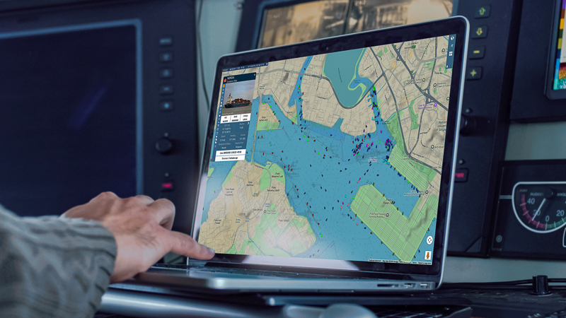
That usually means previous port calls and route patterns, course and speed changes, time spent inside the zone, nearby vessel activity, reported destination and navigational status, any reporting gaps or alternative position sources, and the weather or risk picture in that location. This is why geofencing is most effective when it sits in the same workspace as live tracking, voyage replay and port activity: the user moves from the notification to the evidence without changing systems or losing the thread.
The limits of AIS-based geofencing
Geofencing is only as good as the positions underneath it. Terrestrial AIS coverage thins offshore; satellite reception and revisit intervals vary. Messages can be delayed, duplicated or carry incorrect static information. Some vessels are not required to carry AIS at all, and transmissions are interrupted for both legitimate and illegitimate reasons.
Treat a geofence as an operational alerting tool, not a guaranteed statement of presence, absence or compliance. Where a decision carries real consequence, confirm through onboard systems, agents, port sources or independent position reporting. A platform that hides these limitations is doing its users no favours; one that makes the underlying track inspectable is doing the opposite.
Questions to ask a geofencing platform
- Can users create both circular and custom polygon zones?
- Can alerts be limited to selected fleets, vessel types or watchlists?
- Which event types, thresholds and dwell rules are supported?
- Does the platform combine satellite and terrestrial AIS, and can it show which source a position came from?
- Can a user move directly from an alert to voyage history and port activity?
- Can alerts be routed to different recipients by zone, urgency or team?
- Can zones and rules be shared across a team while controlling who can edit them?
- Are events retained for reporting, investigation and audit?
Turning movement into a trigger
Geofencing is valuable because it converts monitoring from a manual activity into an event-based one. The team stops checking whether a vessel has arrived, crossed a boundary or lingered somewhere it should not have. The platform raises the event; the user applies judgement to the context.
The implementations that last start from a clear operational question, use selective rules, and put movement history one click from every alert.
Zones, alerts and voyage history in one workspace. BigOceanData combines custom geofences, event-based alerting, satellite and terrestrial AIS, port activity and voyage replay, so an alert and the evidence behind it sit in the same place.
We can set up zones on your own fleet in a 30-minute session. Book a demo
Frequently asked questions
What is vessel geofencing?
Vessel geofencing is the use of a digital geographic boundary, whether a circle, polygon or custom zone, to generate an alert when a vessel enters, leaves, dwells in or changes behaviour within a defined maritime area.
How accurate is AIS-based geofencing?
It depends on position quality and frequency. Terrestrial AIS is dense near shore but thins offshore; satellite revisit intervals vary. Treat geofence events as operational prompts rather than proof of presence or compliance.
How do you stop geofence alerts becoming overwhelming?
Limit rules to relevant fleets, use dwell and speed conditions instead of alerting on every entry, separate informational events from urgent ones, suppress duplicates, route alerts to the responsible team, and retire zones that no longer support a decision.
Can you geofence vessels you do not own?
Yes. Commercial teams commonly monitor ports, anchorages and trading areas to understand third-party fleet activity, subject to their organisation’s data and compliance policies.