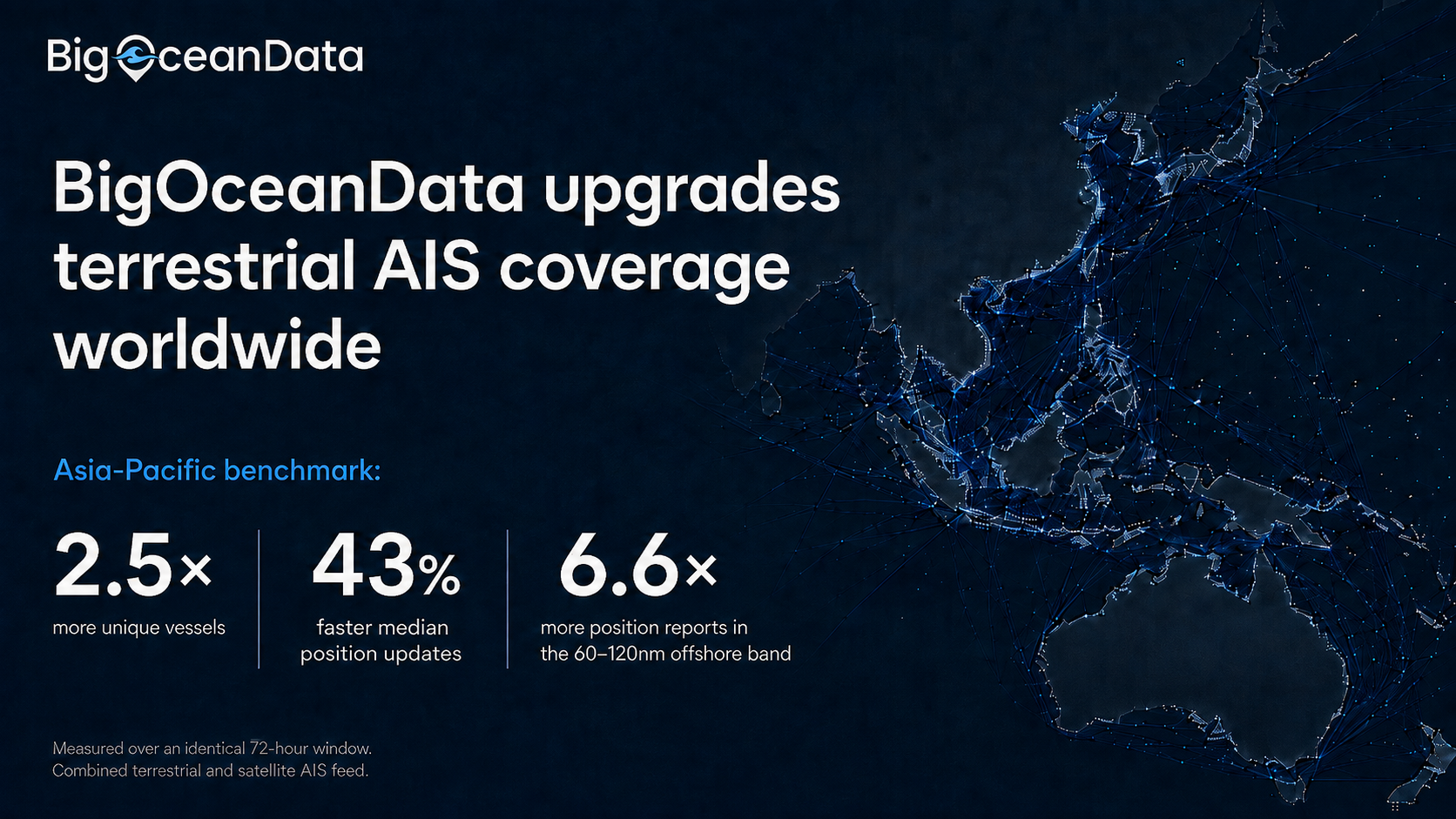


Denser terrestrial coverage strengthens the coastal half of BigOceanData’s combined terrestrial & satellite AIS feed, with an Asia-Pacific sample showing 2.5 times more vessels tracked & position updates arriving 43% sooner.
London, 26 August 2026, BigOceanData today announced a significant upgrade to the terrestrial component behind its vessel tracking platform, substantially increasing the number of vessels visible to customers in coastal and near-shore waters and reducing the time between position updates.
The upgrade targets areas of historically lower terrestrial AIS coverage: stretches of coastline where limited coverage has constrained how much traffic could be seen, particularly the band between busy inshore waters and the range at which satellite AIS becomes the primary source. These coverage gaps have long been a practical constraint for operators monitoring port approaches, coastal transits and regional fleets.
What the upgrade delivers
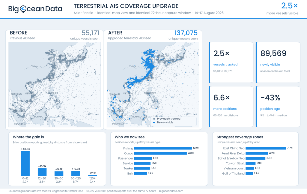
BigOceanData compared its previous feed against the upgraded feed across an identical 72-hour window and an identical map view. In the Asia-Pacific sample analysed, the upgraded feed delivered:
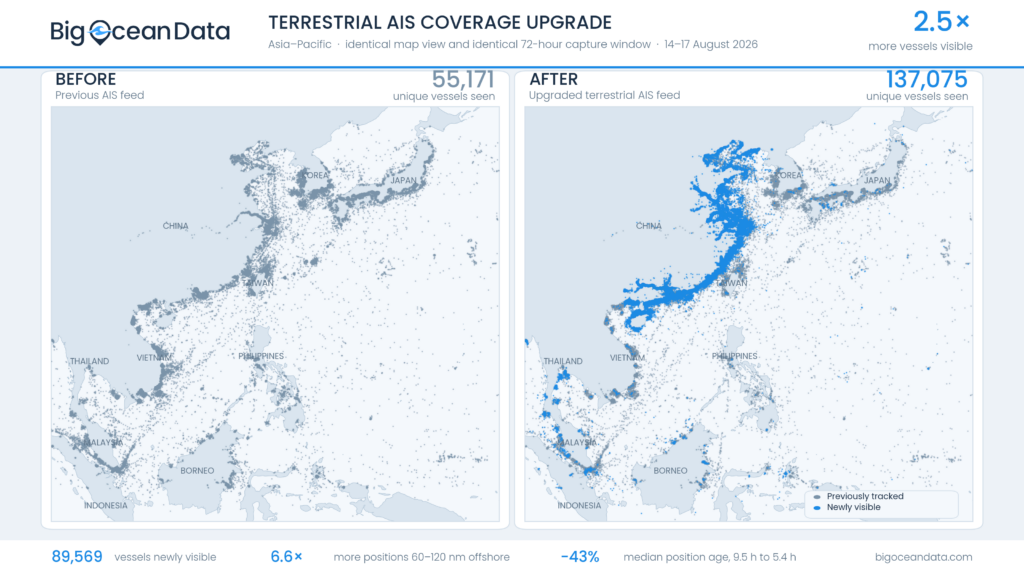
- 2.5 times more unique vessels tracked, from 55,171 to 137,075 across the region
- 89,569 vessels newly visible that did not appear on the previous feed at all
- 6.6 times more position reports in the 60–120 nautical mile band offshore, the transition zone between terrestrial and satellite coverage
- 43% reduction in median position age, from 9.5 hours to 5.4 hours
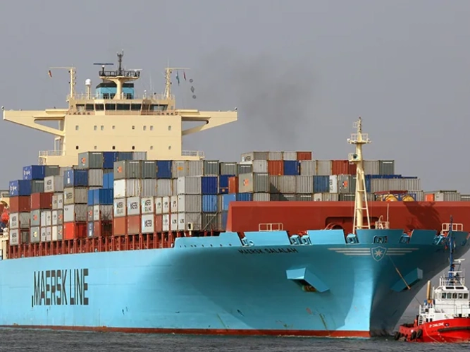
Gains were strongest among vessel types that operate closer to shore, where terrestrial coverage matters most. Fishing vessel position reports increased 5.2 times and cargo vessel reports 4.8 times, while coverage of larger deep-sea tonnage, already well served by existing terrestrial and satellite sources, improved more modestly.
The strongest regional improvements in the sample were recorded in the East China Sea and Yangtze approaches, the Pearl River Delta, and the Bohai and Yellow Seas.
Why it matters
For customers, denser coverage changes what is practical rather than simply adding volume. Port and terminal teams see more of the traffic actually moving through their approaches. Fisheries and environmental bodies see more of the smaller vessels that make up the fleets they monitor. Insurers and risk teams reconstructing a voyage have fewer unexplained gaps in the track. Shorter intervals between position updates mean alerts and zone crossings reflect a more current picture.
“Customers want one map, not separate terrestrial and satellite AIS feeds, and our job is making sure the right vessel is on it. We combine terrestrial and satellite AIS to create that picture. We measured this upgrade the way a customer would judge it: same window, same waters, before and after. In our Asia-Pacific benchmark we saw 2.5 times more vessels, with positions arriving hours sooner.”
Wail Sabbagh, Commercial Director, BigOceanData
The upgrade applies to BigOceanData terrestrial AIS coverage worldwide. Terrestrial AIS remains one input among several: BigOceanData combines multiple terrestrial and satellite AIS sources into a single continuous feed and, for customers who require uninterrupted visibility on specific vessels, integrates independent position sources including Inmarsat-C, Iridium and FleetBroadband reporting.
Availability
The upgraded feed is live for all BigOceanData vessel tracking customers at no additional cost, across the platform and white-labelled deployments. No configuration change is required.
About BigOceanData
BigOceanData provides AIS vessel tracking, route optimisation and maritime intelligence to shipowners, ship operators, fleet managers, insurers, government bodies and maritime security providers. The platform combines terrestrial and satellite AIS into a single continuous feed, supported by alerting, zone monitoring, voyage replay and multi-year movement history. BigOceanData serves more than 200 organisations worldwide and is part of Maritime Cortex Limited.
Media enquiries:
Wail Sabbagh, Commercial Director, +44 (0)7782 325414, wail.sabbagh@bigoceandata.com