
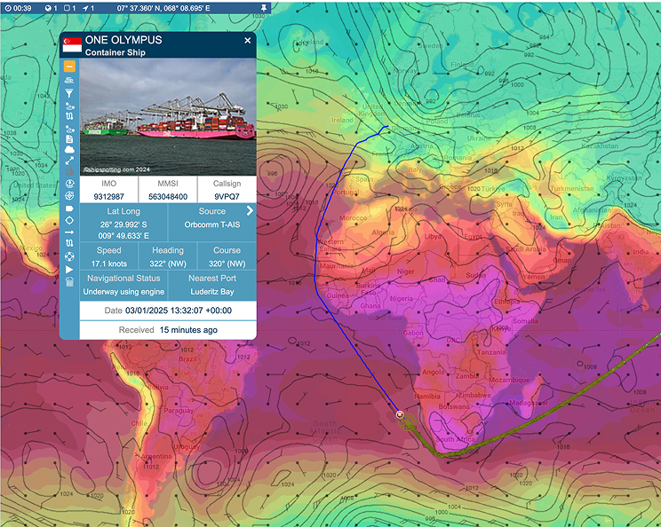
Real-time vessel tracking, built for operational decisions
Monitor vessel movements worldwide with high-accuracy terrestrial and satellite AIS tracking, advanced filtering and alerts across fleet, port and voyage activity.
24 million
Vessel position reports every single day
450K
Vessels tracked
4,500
Ports monitored
96%
BigOceanData clients renew their contracts
Complete Visibility Across Global Waters
BigOceanData delivers real-time vessel monitoring powered by high-quality terrestrial and satellite AIS data, providing reliable coverage where it matters most. Designed for operational teams, analysts and maritime decision-makers, the platform gives users precise visibility at fleet and vessel level.
From real-time alerts, SSAS integration and area monitoring to port and anchorage visibility, voyage replay and fleet activity tracking, Vessel Tracking transforms maritime data into actionable intelligence.
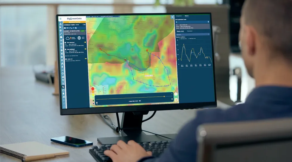
From live monitoring to operational response
BigOceanData helps teams move from vessel awareness into investigation, coordination and action in one connected workflow. Use alerts, zones and SSAS to surface events that need attention, then bring voyage replay, port activity, fleet context and vessel history together to understand what happened and decide what to do next.
The result is faster response, clearer investigations and stronger operational control, without the delays and friction of switching between disconnected systems.
Trusted by leading maritime teams


Powerful Tracking. Advanced Control.

Global Coverage
Satellite and terrestrial AIS with the option to include positions from existing ships systems or dedicated tracking devices ensures continuous vessel visibility.

Advanced Search and Filtering
Identify vessels by type, flag, ownership, activity pattern, speed behaviour or custom-defined criteria.

Fleet and Market Monitoring
Track your own vessels, third-party fleets and wider market activity from a single shared view, supporting both operational oversight and competitive awareness.

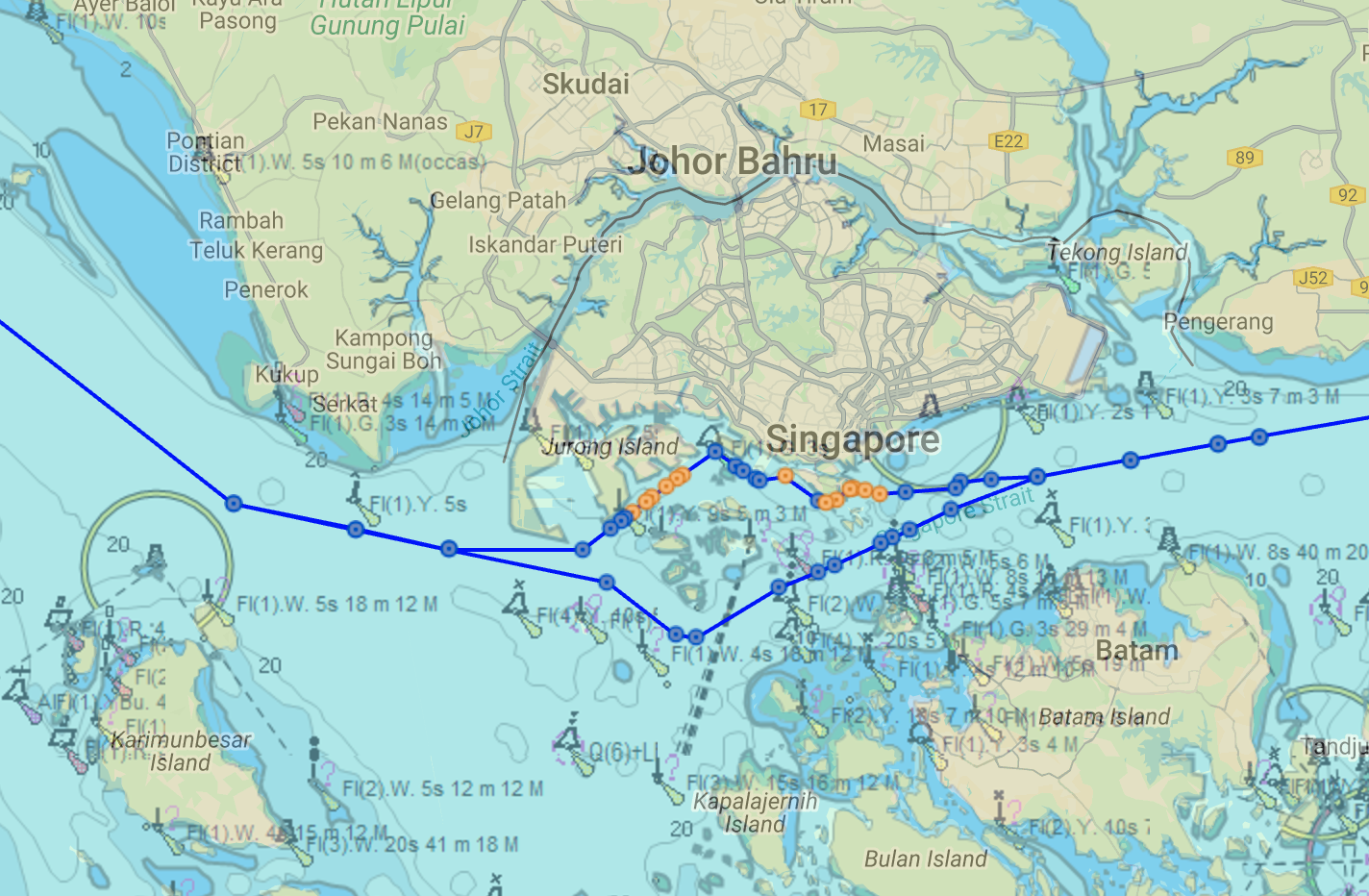
Port Activity and Voyage Intelligence
Monitor expected arrivals, in-port status and departures alongside voyage replay and historical movement data to support planning, investigation and incident review.

Behavioral Analytics
Detect anomalies, loitering, unusual speed patterns and suspicious routing activity to support risk assessment and informed decision-making.

Alerts and Area Monitoring
Define zones, set thresholds and receive event-based notifications for operational or security-sensitive situations before they escalate.
VertomCory: Global vessel intelligence, broader market visibility and faster STS analysis
Trusted by teams who rely on maritime visibility every day


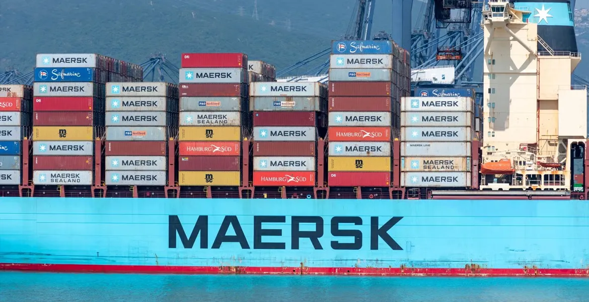
“Maersk needed the ability to track containers. After signing a two-year contract with BigOceanData in September 2016 for vessel tracking services, Maersk extended and expanded the agreement in early 2018 for a further 30 months, covering three times the original number of vessels and nearly double the number of tracked containers. Maersk continues to use the BigOceanData SSAS service, a cost-effective, well-supported solution.”

Stephan Martinussen
Head of GVPC at Maersk

“Our contract renewal with BigOceanData is a testament to the continued excellence of service and support the team provides. BigOceanData has been and will continue to be one of our key service providers at VertomCory, helping us to enhance the service package we provide to our key clients.”
Neil Flower
Agency Director

“Crisis24 is a global risk management and security services company. We commissioned BigOceanData to provide us with a custom-designed vessel tracking and risk management platform for a range of applications with our insurance, marine and offshore oil & gas clients. BigOceanData was responsive to our requirements from the outset; pioneering new ideas to create exactly what we wanted.“
Crisis24

“BigOceanData played a key role in de-risking the return of our vessel, SARBAS, from the Persian Gulf at the onset of hostilities. Their team provided excellent support over a weekend, rapidly setting up frequent Inmarsat-C position updates, seamlessly integrated with AIS data, to support a safer transit. The solution was highly cost-effective and delivered with efficiency and professionalism throughout. The team are a pleasure to work with.”
Mark Robinson
Marine Director
Latest news and insights
News
Bulgarian Shipping Company Renews
A leading Bulgarian shipping company has renewed its partnership with BigOceanData following a highly successful initial term. Operating a fleet of 36 bulk carriers worldwide, the company requires reliable vessel tracking — even in regions where AIS coverage is limited. To address this, we implemented scheduled Inmarsat-C reporting alongside AIS data, ensuring continuous and accurateContinue reading “Bulgarian Shipping Company Renews “

News, Press
International Maritime Security Provider Extends 15-Year Partnership with BigOceanData
A leading international maritime security provider has renewed its long-standing relationship with BigOceanData, continuing to use a white-labelled version of the platform to support its global client base.

News
Partnership Renewal Strengthens Maritime Security Capabilities
BigOceanData’s long-running partnership with Diaplous Maritime Services has been extended, building on collaboration that began in 2020. The agreement provides core vessel tracking services and enhanced area monitoring solutions, providing real-time intelligence on marine traffic within designated regions. The extension reflects growing demand for integrated maritime security and situational awareness, particularly as global shipping routes face evolvingContinue reading “Partnership Renewal Strengthens Maritime Security Capabilities”
News, Press
Maersk-Line Renews Commitment to BigOceanData’s Integrated SSAS
Maersk-Line has once again renewed its commitment to BigOceanData’s integrated Ship Security Alert System (SSAS) for a further term.
News, Press
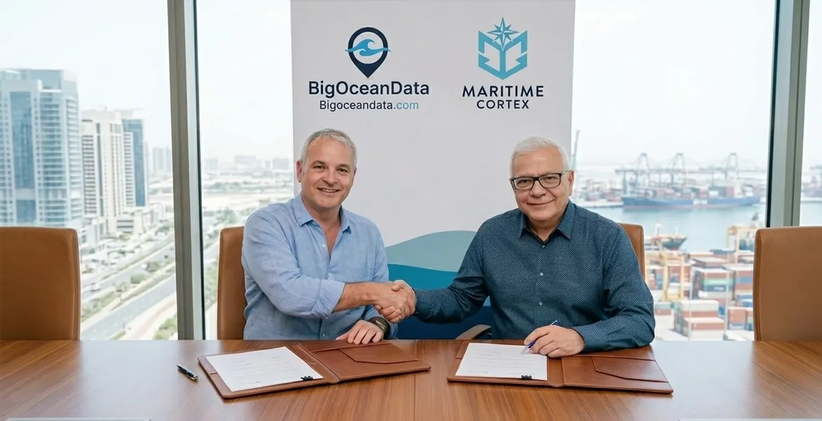
Maritime Cortex acquires BigOceanData to build AI-powered future for global fleet intelligence
Maritime Cortex Limited today announced the acquisition of Big Ocean Data, a maritime vessel tracking and analytics platform serving over 200 commercial, government and environmental organisations worldwide.

News, Press
US-based superyacht management company renews agreement
A US-based superyacht management company has renewed its BigOceanData subscription, continuing to leverage a combination of AIS, Inmarsat-C, and Iridium scheduled reporting to ensure continuous, high-confidence vessel tracking worldwide.
News, Press
European Government Renews BigOceanData Fisheries VMS Contract
BigOceanData is proud to announce that a major European Fisheries Department has extended its use of our Fisheries Vessel Monitoring System technologies and support for a 12th year!

News, Press
European Bulk and Tanker Operator Extends Use of BigOceanData Vessel Tracking
A long-standing European-based bulk and tanker operator has extended its use of BigOceanData’s advanced vessel tracking services for an eighth year.
News, Press
Cory Brothers Extends BigOceanData Contract for a Further Two Years
BigOceanData is pleased to announce the renewal of its contract with Cory Brothers, a leading global provider of logistics and maritime services. The agreement extends the partnership for another two years.
Frequently Asked Questions
Our questions and answers page is intended to give you a greater understanding of maritime operations and AIS data.
BigOceanData Vessel Tracking provides real-time and historical visibility of vessel movements globally. It combines multiple AIS data sources with maritime intelligence to give a clearer and more reliable view of fleet and vessel activity.
BigOceanData combines multiple AIS data sources, including terrestrial AIS, satellite AIS and additional maritime data inputs, improving coverage and reliability compared to single-source solutions. Update frequency depends on AIS source and location, but BigOceanData combines multiple feeds to improve update rates and consistency.
Accuracy depends on AIS signal availability, but by combining multiple data sources, BigOceanData improves position frequency and reliability, particularly in challenging areas such as open ocean or high-traffic regions.
Yes. The platform provides global coverage, including coastal and open ocean regions, supported by satellite AIS and terrestrial networks.
BigOceanData enhances visibility by combining multiple data sources and applying intelligence to vessel movements. While AIS gaps can occur, the platform helps provide a more complete operational picture than single-source solutions.
Yes. Users can track their own fleet as well as third-party vessels, supporting operational monitoring, chartering, market intelligence and risk awareness.
Yes. Users can set up alerts for vessel movements, port arrivals and departures, and defined geographic areas to stay informed and respond quickly.
Yes. BigOceanData provides access to historical vessel data, allowing users to analyse past voyages, trading patterns and operational behaviour.
Vessel tracking is one of the three core pillars of the BigOceanData platform, alongside Route Optimisation and Maritime Intelligence, enabling connected operational decisions.
BigOceanData combines multi-source AIS data, operational workflow tools, route optimisation and maritime intelligence to provide a more connected decision-making platform.