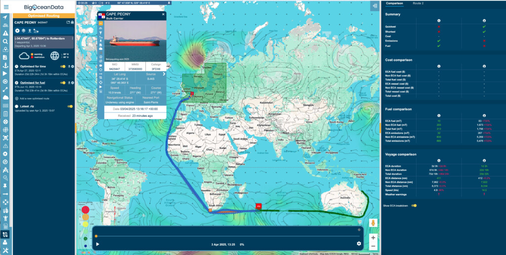
Weather Optimised Routing for Greener, More Efficient Voyages
BigOceanData’s Weather Routing and Voyage Optimisation technology offers far more than standard voyage planning and navigation. In association with ABB Marine & Ports the world-renowned provider of weather routing solutions, BigOceanData leverages detailed analysis of vessel performance across varying weather conditions, sea states, and speed ranges to generate highly efficient, weather-optimised voyage plans. These routes can be tailored to prioritise time, fuel consumption, fuel cost, or total voyage cost, while incorporating user-defined constraints such as weather thresholds and geographical no-go zones.
Reduce voyage costs & emissions with the new, intelligent Optimal Speed Routing, a ground-breaking feature designed to optimise vessel speed for substantial fuel savings.

Benefits include
- Integrated solution – It can be used onboard and/or shoreside to provide fleet wide integrated route optimisation.
- Limitless usage – Empowers users to simulate ‘what if’ scenarios, analyse outcomes and make data-driven decisions with clarity and confidence.
- Update frequency – Automatic and manual mid-voyage re-optimisation ensure real-time responsiveness to changing conditions.
- ECDIS Integration – Onboard access to route advice in RTZ or CSV format, ensuring smooth integration with ECDIS systems.
- Predict and Reduce Emissions – Using past voyage data, we estimate CO₂ output and fuel consumption to help you stay compliant with CII objectives and sustainability goals.
- Green and Cost-Effective Routing – Our system ensures that each route is safe, timely, fuel-efficient, and low-carbon, balancing environmental responsibility with operational savings.
- Smart Decision-Making – Gain insights that preserve green credentials while optimising performance and costs.
Implementing limitless weather-optimised routing capability to your operations delivers a measurable Return on Investment (ROI) through a modular, partnership-driven approach. This empowers maritime operators for further optionality on reducing fuel consumption and emissions, and other operational costs. In close collaboration with ABB Marine and Ports, clients typically achieve at least 5% savings on total fuel costs, a major operational expense, whilst the monthly cost of this solution is less than 1 metric ton of fuel per vessel. It not only lowers operational expenses but also enhances schedule reliability and asset longevity. Over time, these benefits compound, making weather-optimised routing a cost-effective and strategic investment.
Using BigOceanData’s optimised speed routing can deliver circa 30% total voyage cost savings compared to standard weather routing!
![]()